PhotoTrek: Terminal Wayfinding & Expedition Suite
A Photo Map for Hikers & Wild Places
A photography and trail map designed to help outdoor explorers find stunning mountain views while protecting delicate trails and wildflowers.
Architecture Highlights
- •Fast, lightweight website built with Astro and hosted on Firebase.
- •Clear, high-resolution photography optimized for phones and tablets.
- •Companion apps for Android and Flutter that work even when you have no cell signal.
- •Regional trail markers that protect fragile plant and animal habitats.
Engineering Hurdles Solved
- •Making high-resolution photos load quickly on slow cell connections in the woods.
- •Helping hikers navigate while keeping delicate wilderness spots safe.
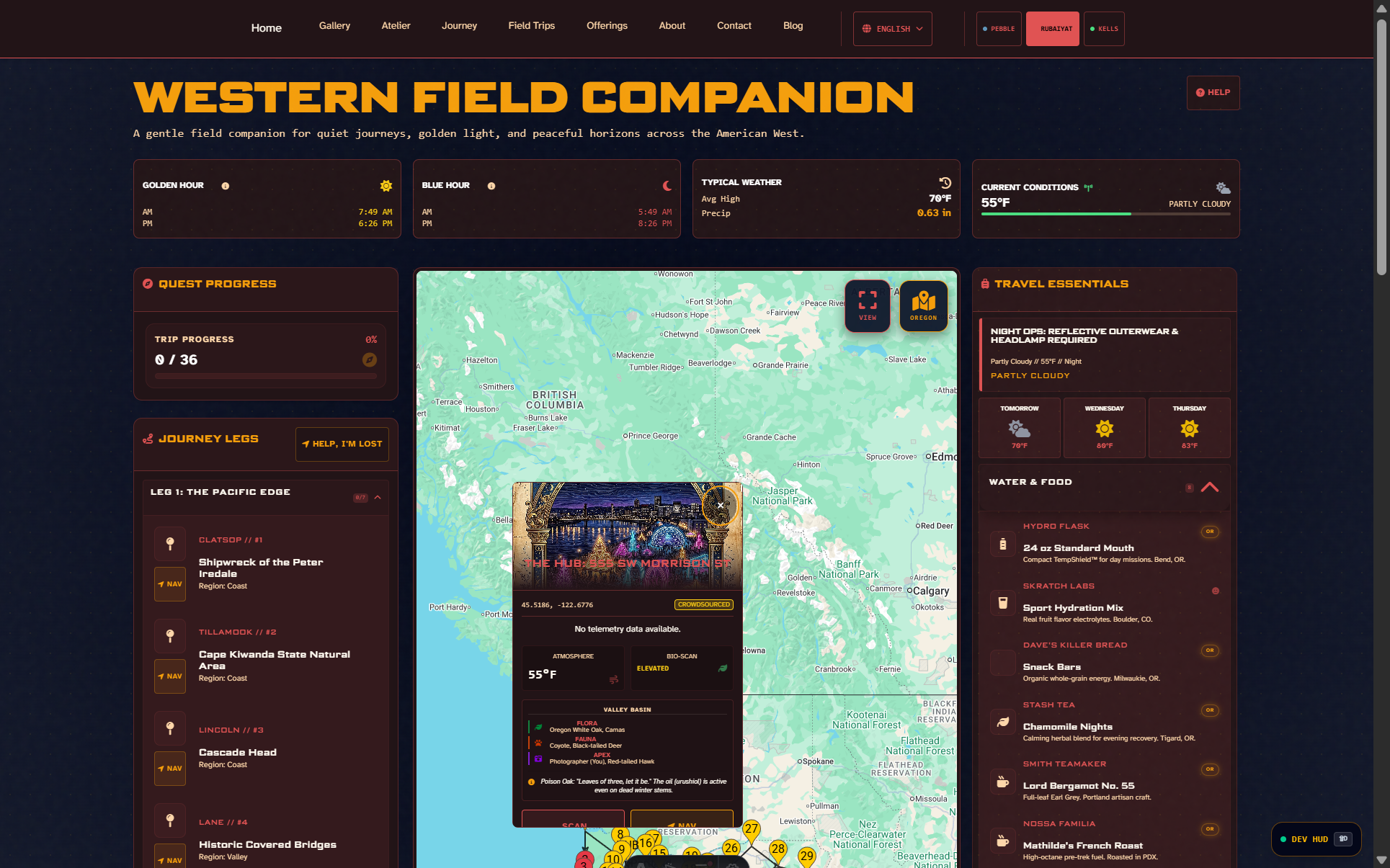
Overview
PhotoTrek combines fine-art landscape photography with simple trail wayfinding. It is built for hikers, photographers, and outdoor lovers who want to explore the Pacific Northwest while respecting nature and leaving no trace behind.
Standard social media photo apps have triggered catastrophic overcrowding in pristine wilderness areas—geotagging sensitive wildflower meadows and wildlife habitats for algorithmic virality. PhotoTrek inverts this destructive dynamic by implementing Regional Landmark Wayfinding and strict ecological privacy safeguards.
Pinpoint GPS micro-geotagging causes irreversible trail erosion, trampling of fragile subalpine blooms, and raptor nest abandonment. PhotoTrek deliberately generalizes coordinates:
- Regional Waypoint Averaging: Guides explorers to durable public trailheads, established parking areas, and designated scenic viewing corridors.
- Sensitive Off-Trail Habitat Defense: Delicate subalpine meadows and wetland coordinates are stripped of exact coordinates, preserving natural ecosystems.
Protecting Wild Places & Residential Privacy
1. Residential Privacy Quarantine
Every photo ingestion batch automatically runs through an automated coordinate quarantine filter. Any frame captured near private residences or non-public property is scrubbed of GPS metadata and routed to private-residential-quarantine.json to guarantee residential privacy.
2. Dark-Sky Reserve & Solar Ephemeris
Instead of encouraging artificial flash photography, PhotoTrek’s solar engine calculates exact astronomical twilight, golden hour, and moon phases—encouraging visitors to observe natural ambient light, understand stellar geometry, and support Dark-Sky preservation.
🗺️ Core Architecture Pillars
[EXPEDITION VISTAS] ──► [FIREBASE STORAGE BUCKET] ──► [ASTRO TERMINAL & ASCIICRAFT STUDIO]
                              │                                  │
                              ▼                                  ▼
[ANDROID JETPACK COMPOSE] [FLUTTER MULTI-PLATFORM]-
Terminal Cartography & AsciiCraft Studio: An interactive solar wayfinding generator that translates real-time solar elevation and azimuth coordinates into dynamic Pacific Northwest vector landscapes. Powered by an abuse-proof pregenerated database and a standalone CLI Python generator.
-
Cloud Image Pipeline: Automated streaming from Google Cloud / Firebase Storage buckets (
pgbizastroidx.firebasestorage.app) delivering full-fidelity WebP thumbnails and web master assets with integrated EXIF camera data. -
Multi-Platform Expedition Ecosystem:
- Web Engine (
pgphototrek): Astro 5, Tailwind CSS v4, GSAP animations, WCAG AAA contrast compliance. - Android Journey (
phototrek-journey-android): Kotlin, Jetpack Compose, Material 3, and offline telemetry caching. - Flutter Explorer (
phototrek-journey-flutter): Multi-platform journey replay and VRPTW time-window return routing.
- Web Engine (
Explore More Systems
View full portfolio of AI architectures, creative technology, and open systems.